The neighbourhood
Alamo Plaza and the river
The ground around the show: the Alamo and its plaza, the historic buildings that face it, and the River Walk a level below, with the way between them.
Find a show night ↗The Alamo
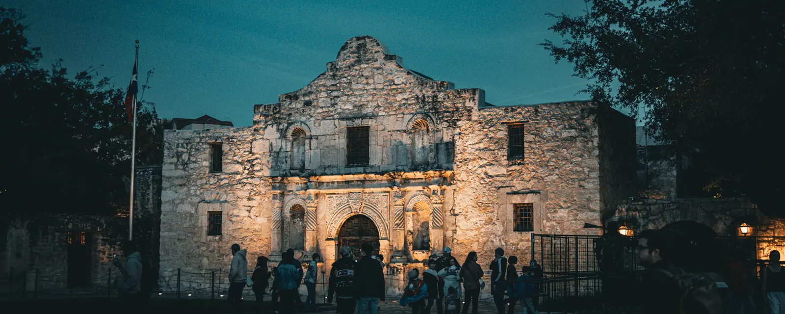
The Alamo began as Misión San Antonio de Valero, a Spanish mission founded in the 18th century by Catholic missionaries. It was secularised in 1793, later housed a military company that probably gave it the name Alamo, Spanish for cottonwood tree, and in 1836 was the site of the Battle of the Alamo, a pivotal event of the Texas Revolution. Today it is a museum, and since 2015 it has formed part of the San Antonio Missions World Heritage Site with four missions further south.
The plaza around it
The Alamo stands within the Alamo Plaza Historic District, a National Register of Historic Places listing since 1977. The plaza's layout and landscaping were designed in the late 19th century by the city alderman Anton Wulff, whom local business leaders thanked with a gold-topped walking stick. Among the buildings that face the plaza are the Menger Hotel, built in 1857, and the Crockett Hotel of 1909, both overlooking the Alamo, along with a row of 19th-century commercial buildings.
The River Walk below
A level down from the streets runs the River Walk, a city park and pedestrian street along the San Antonio River. Its two parallel sidewalks wind under bridges past restaurants and shops and connect many of the city's draws, from La Villita to the Arneson River Theater. The River Walk grew from the architect Robert Hugman's plans of 1929, and Casa Rio, which opened in 1946, was the first restaurant on its banks. During Fiesta San Antonio each spring, a river parade of flower-covered floats drifts along the water. The land inside the river's loop was the heart of the 1700s outpost of Villa de Bejar, the settlement that grew into the city.
Between the plaza and the water
The plaza and the river are close neighbours. From the downtown stretch of the River Walk, Alamo Plaza is a short walk up at street level. A pedestrian connector called the Paseo del Alamo, which opened in 1981 with a downtown hotel, links the two: its water flows from the plaza into the river, joining what Wikipedia calls the city's two largest tourist attractions. If you are heading to the magic show, allow for the climb from river level and arrive early for the parlour.
The missions further south
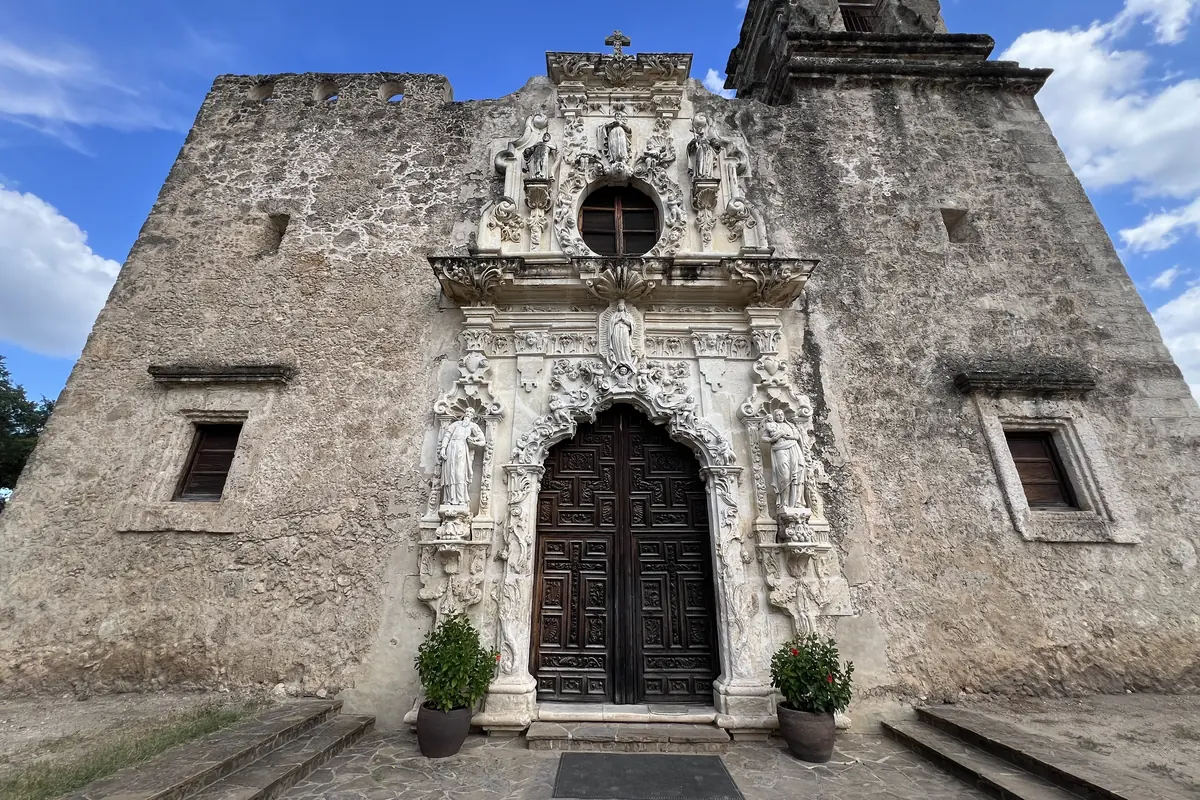
The Alamo is one of five Spanish missions in San Antonio. The other four, Concepción, San José, San Juan and Espada, make up the San Antonio Missions National Historical Park along the river south of downtown, and on 5 July 2015 the park and the Alamo were together named a UNESCO World Heritage Site. Portions of the four missions still serve as active parishes. A guided half-day tour from downtown is the simplest way to see all four before an evening on the plaza, with the Espada aqueduct and its old irrigation channel along the way.
Frequently asked questions
Is Alamo Plaza near the River Walk?
Yes. Alamo Plaza is a short walk up from the downtown stretch of the River Walk, and a connector called the Paseo del Alamo links the two.
When did the Alamo become a World Heritage Site?
On 5 July 2015, together with the four missions of the San Antonio Missions National Historical Park.
Why is the River Walk below street level?
It grew out of flood-control work after the 1921 flood, when plans to pave over a bend of the river gave way to Robert Hugman's design for a walkway along it.
Sources
- English Wikipedia, article on the Alamo Mission (consulted November 2026)
- English Wikipedia, article on the Alamo Plaza Historic District (consulted November 2026)
- English Wikipedia, article on the San Antonio River Walk (consulted November 2026)
- English Wikipedia, article on the San Antonio Missions National Historical Park (consulted November 2026)